Shrink-swell potential is the phenomenon of soil flexing based on moisture levels within a given soil. Types and quantities of clay within a soil contribute to its expansion and contraction. The clay properties of the soil contract or shrink when the soils’ water content is low and expand or swell when the soils’ water content is high. These inconsistencies within moisture levels of soil can lead to serious damage to buildings, as noted by the British Geological Survey:
“Shrinking and swelling of the ground (often reported as subsidence) is one of the most damaging geohazards in Britain today, costing the economy an estimated £3 billion [$4.6 billion USD] over the past decade” (2010).
Shrink-swell is of particular importance to home buyers, who are often undereducated on the topic. Because damage can consist of cracked walls and even foundations, costs for repairs can be exorbitant. General quotes for repairing a crack in a foundation can run between $500 and $800, while a complete foundation overhaul can run between $8,000 and $14,000 and for more extreme cases $30,000 (Foundation Repair Network 2010). These costs are easily avoided by choosing properties based on which soils have less shrink-swell potential than others. Homes with shallower foundations tend to be more susceptible to shrink-swell damage while deeper foundations can find more stability near the stronger bedrock. There are also preventative building techniques that can limit the amount of shrink-swell though never completely eliminate it (Wiltshier 2004).
Checking for and eliminating leaking water around the home that could periodically moisten the soil is important for reducing shrink-swell cycles. Intermittent irrigation around yards and walls of the structure should be avoided. Ways of controlling the water content through preventative methods can also curb potential damage. Installing an underground impermeable skirt can keep water from penetrating directly below the structures’ foundation. A common practice of paving the surrounding perimeter of the home or structure works very similar to the impermeable skirt just above ground (Wiltshier 2004).
Tree roots have also been a noted problem in encouraging shrink-swell potential. Since trees need moisture they pose problems if they are located near the foundation of a structure where there is potential for shrink-swell. A recommended distance to propagate trees is two times the distance of the tree’s height from the structure’s base. This allows for the trees to intake moisture without interfering with the moisture content at the structure’s foundation (Wiltshier 2004).
Taking the above factors into consideration, this paper will focus on locations in the East Bay of San Francisco Bay Area, particularly Alameda County, that have the highest potential for damage due to shrink-swell. Using GIS, I have located areas with dangerous combinations of shrink-swell susceptibility ratings. Often alluvial soils, or flood prone soils, have a high content of clay, causing more potential for shrink-swell to occur in many parts of the East Bay.
Data collection for this report includes: USDA Soil Survey GIS layer of Map Units retrieved from USDA Geopspatial Database and USDA Soil Survey (hard copy), GIS parcel map of Alameda County from Alameda County Geospatial Data Files, Bay Area city boundaries retrieved from City and County of SF, and California GIS highway and roads from Ca.gov GIS Cal-Atlas Geospatial Clearing House.

In order to limit the scope of the map, many layers have been clipped. The soil map units layer was provided by the USDA’s Geospatial Database with its foundations based with the Natural Resources Conservation Service who also had provided a complimentary hard copy of the Soil Survey of Alameda County, California, Western Part which explains the soil map units are considered to be “unique natural landscape[s]”. These units indicate the soil’s characteristics and capabilities. Through these descriptions, I created an excel table based on shrink-swell potential and joined it to the soil map units layer. I then reclassified the data as follows: low, low moderate, moderate, moderate high and high potential of shrink-swell. See Shrink-Swell Class map.

In order to show the most damage prone parcels of land within the East Bay, I analyzed land parcels that shared a mix of highest and lowest potential for shrink-swell to take place. See Parcel Intersection Map. With a portion of these parcels of land having a very stable foundation and with the adjacent portion being prone to great swelling and shrinking, there is a higher potential for foundations to become cracked and damaged. This shrinking and swelling is most problematic when the soil is distributed in an inconsistent manor such as in the “hazard prone parcels” map. By using the reclassified soil map units I was able to use the “selection by location” option within ArcMap to clip the highest and lowest potential layers out. With these layers I could then locate which parcels were along each of their boundaries and then ultimately to locate which parcels were shared by both of these extremities.

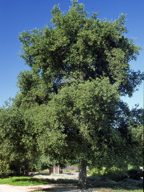
Next, since trees planted in shrink-swell areas can amplify the instability in high shrink-swell potential soils, as mentioned earlier, I analyzed areas of suitability for trees. A common tree within the Bay Area is the California Live Oak. By taking twice the Live Oaks’ average height of 80 feet, a safe planting distance from the foundation of the structure that has no root protection can be found. I then buffered the appropriate distance in which they should be planted in order to avoid exacerbating the shrink-swell problem of these soil. This knowledge of property planning can be extremely valuable when considering the potential cost in repairs and damages that can accrue from lack of action (Howell 1986).

The University of Texas at Austin: Lady Bird Johnson Wildflower Center
These maps help to illustrate the inconsistencies of shrink-swell potential within the Alameda County region, areas that can be at great risk for damage to building foundations. Significant trends appear within the maps that give the viewer insight into soil types and suitable planning areas. The waterfront locations through Emeryville and Oakland show extended shared boundaries of extreme high and low risk for shrink-swell potential and would ultimately cost more to build upon. Preventative methods such as using building pads to help drain water from the foundation of a structure would potentially have to be implemented in order to start construction.
Soil properties present various complexities in terms of building limitations. However, limitations to building limitations as a whole are far more expansive than what is explored within this report. Issues such as liquefaction, inundation, etc. also need to be considered before construction. This report focuses on only one important factor—shrink-swell potential—which is considerably wide spread in the East Bay. Possibilities of other dangerous combinations of shrink-swell can occur, which could also spell disaster for homes throughout these areas if proper building techniques are not taken into account ahead of time, though this report illustrates the most extreme combination of high and low risk of shrink-swell potential. Parcels completely within the high shrink-swell risk areas are prone to high damage as well, though the uniformity within those soils could lead to lesser damage. Damage report data from the problem areas would be valuable in order to confirm the ideas shown in the maps. Though determining whether cracks in walls or foundations were caused by shrink-swell versus another factor is difficult. As Wiltshier indicates,
“There are many other potential causes of cracking to masonry buildings including:
• Consolidation of poorly compacted soils (either natural soils or fill) when loaded with the weight of a building;
• Vibration causing consolidation of soils (eg traffic, construction activities,
earthquake, mining blasting);
• Mine subsidence due to underground tunneling;
• Wash out or softening of the ground below the footings due to saturation by
• Subsurface flow (e.g. stormwater or broken service pipes);
• Corrosion of lintels or embedded steelwork or decay of embedded timber within walls;
• Earthquake or wind loads;
• Deterioration of materials (e.g. failing rubble walls)” (2004).
Unfortunately, these factors complicate the access to data based around this phenomenon. Regardless of this fact, shrink-swell is a serious problem of clay based soils and should certainly be considered when purchasing a home or business especially within these mapped areas.
Bibliography
Alameda County: County Geospatial Data Files. Alameda Parcel (GIS shapefile). <http://www.acgov.org/gis.htm> data retrieved 3/10/10.
British Geological Survey: Natural Environment Research Council. Ground Shrinkage and Subsidence. <http://www.bgs.ac.uk/science/landUseAndDevelopment/shallow_geohazards/shrinking_and_swelling_clays.html> retrieved 3/10/10.
City and County of San Francisco: SFGIS Data Catalog. Bay Area Cities (GIS shapefile). <http://gispub02.sfgov.org/website/sfshare/index2.asp> data retrieved 3/10/10.
Foundation Repair Network. Average Foundation Repair Costs and Variables. 2010. <http://www.foundationrepairnetwork.com/cost.html> retrieved 3/12/10.
Howell, J.T. Quercus acroglandis Kellogg; Q. agrifolia var. oxyadenia (Torrey). Flora of North America. Volume 3. 1986. <http://www.efloras.org/florataxon.aspx?flora_id=1&taxon_id=233501005> retrieved 3/15/10.
State of California: Cal-Atlas Geospatial Clearing House. California Highway (GIS shapefile). <http://atlas.ca.gov/download.html> data retrieved 3/10/10.
State of California: Cal-Atlas Geospatial Clearing House. California Local Roads (GIS shapefile). <http://atlas.ca.gov/download.html> data retrieved 3/10/10.
United State Department of Agriculture (USDA): Geospatial Database. Soil Survey, Alameda County(GIS shapefile) <http://datagateway.nrcs.usda.gov/OrderStatus.asp?OrderID=1161564> data retrieved 3/10/10.
The University of Texas at Austin: Lady Bird Johnson Wildflower Center. <http://www.wildflower.org/image_archive/640x480/SAW/SAW_02976.JPG> image retrieved 3/15/10.
Wiltshier, Simon. Cracking of Buildings due to Shrink/Swell in Clay Soils. Technical Advisory Group (TAG) of the Heritage Council of NSW. May 2004. <http://www.heritage.nsw.gov.au/docs/TAG_cracking.pdf> retrieved 3/09/10.


